
Eart Observation Applications
Owing to its large area and repetitive coverage at relatively low cost, Earth Observation (EO) has been used for decades for crop vegetation monitoring at different spatial scales.
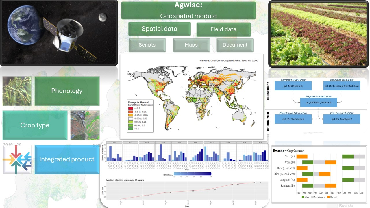
Compared to crop growth models, remote sensing provides a physical measurement of crop vegetation and its temporal and spatial development and hence are very useful to monitor actual crop development.
Within AgWISE, EO and statistical models are combined to provide complementary information to crop models on crop development. Particularly we provide information on the crop type area and crop planting date.
The objective of the AgWISE Remote Sensing module is to provide information on crop type probability areas and crop planting dates based on EO and using cutting-edge data analytics.
Crop type probability areas maps allow to have information on where each crop is predominantly grown and hence can be used to refine agronomic advises (e.g. fertilizer recommendation) based on the areas actually covered by the crop.
The crop planting dates information are used to supplement the information provided by crop models and to all the end users to have a comparison between the actual planting dates (i.e.. coming from EO) and the optimal planting date (i.e.. coming from the crop model).
This can serve as a basis for yield gap analysis but also to better understand farmers adaptations to climate change.
The AgWISE Remote Sensing module has been designed to be able to run at large scale (up to national scale) while using a minimum ground data as input.